Go and See: The Man Who Walked China to Map It Himself
Hook
Imagine every map you'd ever seen of your own country was drawn by someone who had never actually visited most of the places on it — someone who copied older maps, added a few guesses, and called it finished. Would you trust that map to tell you what a mountain, a cave, or a river actually looked like? Or would you want to go see it yourself?
In Ming dynasty China, one man decided that maps and old geography books simply weren't good enough, and that the only way to really understand the land was to walk it, in person, for as long as it took.
Core Concept
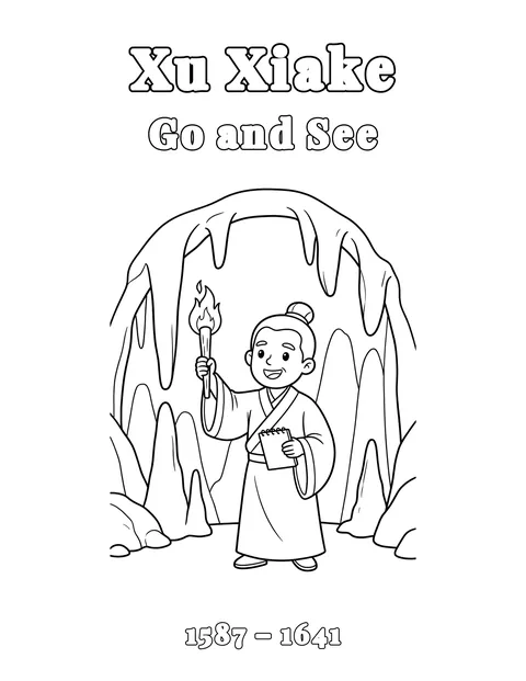
His name was Xu Xiake (pronounced shoo shyah-kuh), born in 1587. Unlike many educated men of his era, Xu Xiake had little interest in the traditional path toward a government position through formal exams. What he wanted instead was to see the actual physical land of China with his own eyes — its mountains, its rivers, its caves, its rock formations — rather than rely on centuries-old written descriptions that were often vague, outdated, or simply wrong.
Foundational Method
So starting as a young man and continuing for roughly 30 years, Xu Xiake traveled almost entirely on foot across enormous stretches of China, often through difficult, remote terrain that most travelers of his time avoided entirely. He carried little, moved constantly, and kept detailed daily travel journals recording exactly what he observed (distances, rock types, water flow, cave structures) with a level of careful, systematic detail that was unusual for travel writing of any era, let alone his own.
One of his most remarkable areas of study was karst landscape: the distinctive terrain formed when water slowly dissolves certain kinds of rock, especially limestone, over long periods of time, carving out caves, sinkholes, and dramatic stone towers. Over the course of his travels, Xu Xiake personally explored and documented more than 100 caves, measuring their dimensions, describing their internal structures, and recording how water moved through them. Some historians consider his observations to be among the earliest systematic scientific studies of karst landscapes anywhere in the world, quite possibly predating similarly careful European studies of the same kind of terrain by roughly a century, though the exact gap is difficult to pin down precisely and comes from a single, specific historical comparison rather than broad agreement.
Xu Xiake's fieldwork also settled a genuine geographical question that had gone unresolved for a very long time: the true source of the Yangtze River, one of the longest rivers in the world. Older maps and texts pointed to one river as the Yangtze's origin. Xu Xiake traveled to the region himself, traced the waterways firsthand, and determined that a different river, the Jinsha River, was actually the true, longer source. He wasn't guessing or relying on older authorities. He went and checked, on foot, over difficult terrain, until he had an answer he trusted more than anything written before him.
Scientist Portrait
What set Xu Xiake apart wasn't a single dramatic discovery — it was the sheer, sustained discipline of his method. He didn't take one trip and write one book. He kept traveling, kept measuring, kept recording, for roughly three decades, often in conditions that were genuinely difficult and occasionally dangerous. His journals, later compiled into what's known as the Xu Xiake Youji ("Travel Diaries of Xu Xiake"), remain a remarkably detailed firsthand record of Chinese geography from someone who insisted on seeing everything himself before writing it down.
Much of his most demanding travel came late in life, through the mountainous, cave-riddled southwest of China: regions like Yunnan and Guizhou, where the karst landscape he studied is especially dramatic. He pushed himself through this terrain even as his health began to fail, and he made it home from his final expedition only shortly before his death. He kept going, in other words, for about as long as his body physically allowed him to.
Connection to Your World
You don't need thirty years or a hundred caves to borrow a piece of Xu Xiake's approach. The next time you're curious about a hill, a stream, or a rock formation near where you live, try actually going to look closely at it instead of just imagining what it's probably like. Notice how the water moves, what the rock looks like up close, how the land is actually shaped, rather than assuming a map or a photo already told you everything worth knowing.
Wonder Question
Xu Xiake spent thirty years proving that even well-established maps and centuries-old texts could be incomplete or simply wrong about the physical world, and that the only way to really know was to go see for yourself. So here's something to wonder about: with satellites and detailed maps covering almost everywhere on Earth today, do you think there's still value in going to see a place with your own eyes, and if so, what might a mapmaker sitting at a desk still miss that only someone standing there would ever notice?
Sources & further reading(2)
Start here
- Xu Xiake · Physics Today
A short piece on Xu Xiake's discoveries, including the true source of the Yangtze.
Go deeper
- Wading Barefoot through a Mountain Stream: The Travel Diaries of Xu Xiake (1587–1641) · James M. Hargett (editor and translator)
Xu Xiake's own travel diaries in a new, fully annotated English translation, free to read online.
Last checked November 10, 2026 · Spot an error? Tell us